Opening Times:

8.00 AM - 5.00 PM

A surveyor in a safety vest operates a theodolite on a tripod at a residential construction site, with houses and traffic cones visible in the background.

Avoid Overpaying: Know Existing Condition Survey Massachusetts Cost

Ever heard of homeowners or developers in Massachusetts facing budget blowouts over simple oversights? Here’s a startling truth: skipping or underestimating the cost of an existing condition survey can add more than 20% in unforeseen construction expenses—straining your project and peace of mind before you even break ground

Revealing the Truth About Existing Condition Survey Massachusetts Cost

“Did you know that skipping an existing condition survey in Massachusetts can lead to unexpected construction costs exceeding 20% of your project budget?” – Industry Expert

Professional land surveyor using total station at a Massachusetts construction site, showcasing existing condition survey Massachusetts cost

Understanding the existing condition survey Massachusetts cost is critical for every property owner and real estate professional. Whether you’re developing a new residence or planning a commercial building addition, knowing survey costs ensures your project stays on budget and compliant. Many property owners encounter surprise expenses when site conditions are not fully documented, making it vital to clarify what drives survey pricing and how it fits into your construction budget. In the sections ahead, we break down what these surveys are, how fees are determined, and best practices to keep costs manageable without sacrificing accuracy.

For those comparing survey options, understanding the differences between boundary, topographic, and ALTA surveys can help you select the right service for your project. You can find a detailed breakdown of land survey types and average costs in Massachusetts to further inform your decision-making process.

What You’ll Learn About Existing Condition Survey Massachusetts Cost

  • What existing condition surveys are and why they matter for real estate and construction projects
  • How survey costs are calculated in Massachusetts
  • How to avoid paying too much for land surveys and understand average cost ranges
  • Key factors influencing existing condition survey Massachusetts cost
  • Tips for choosing the right land surveyor and understanding different types of land surveys

Understanding Existing Condition Survey Massachusetts Cost: Definition & Purpose

Modern architectural plan with site survey overlay, explaining existing condition survey Massachusetts cost

What Is an Existing Condition Survey?

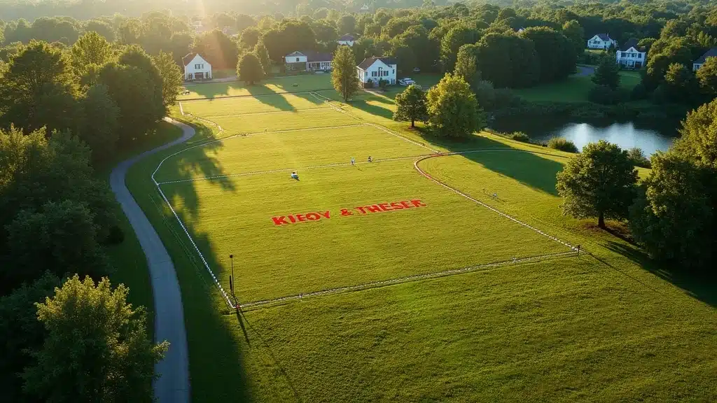
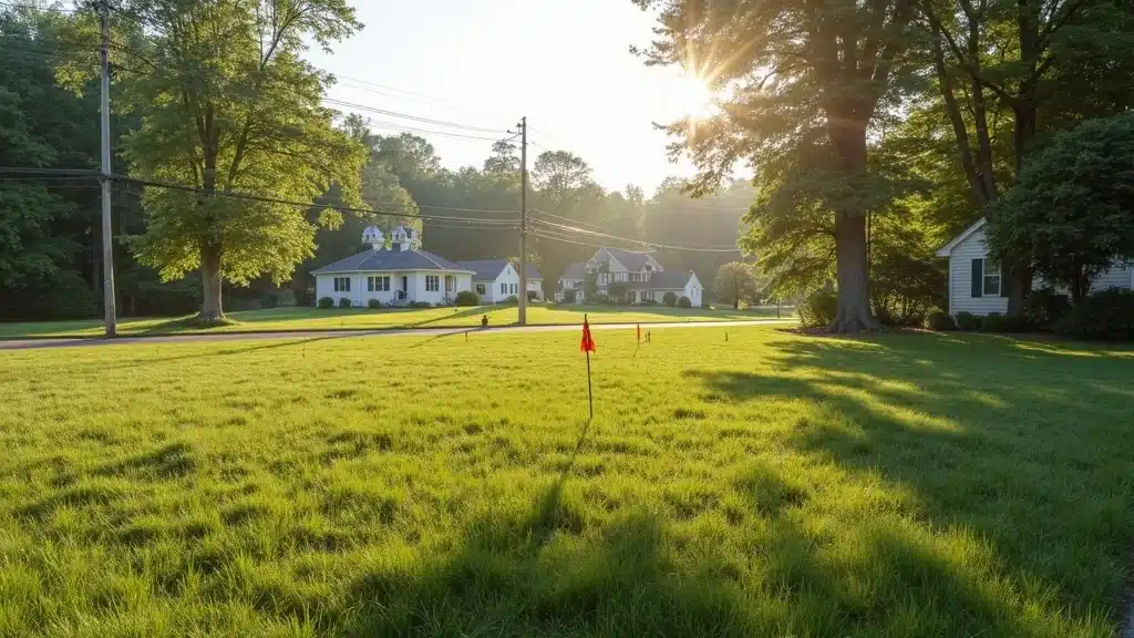
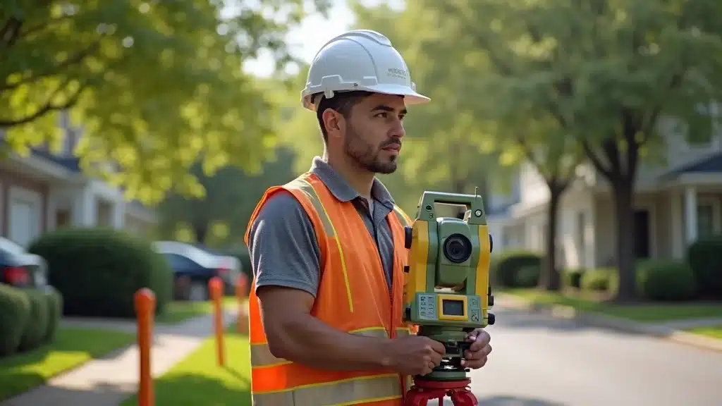
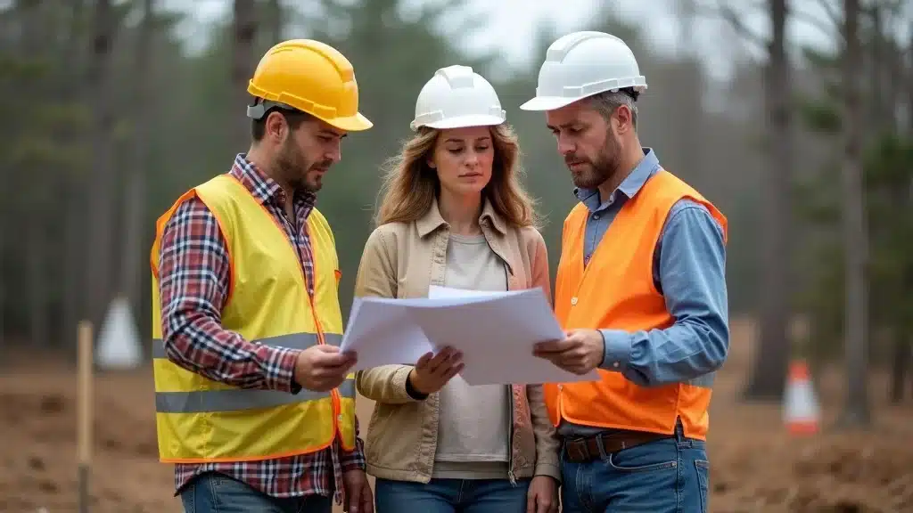
An existing condition survey is a specialized assessment that captures the current physical state of a property. This land survey documents visible features—topography, boundaries, structures, pavement, landscaping, utilities, and even subtle terrain changes—before new construction or renovation begins. In Massachusetts, these surveys are an essential starting point for both residential homeowners and commercial developers, establishing a reliable baseline for real estate projects and ensuring legal compliance with local regulations. Unlike a simple boundary survey, the existing condition survey delivers a comprehensive “snapshot” of a property’s real condition. Surveyors utilize advanced tools (like total stations, GPS units, and drone mapping) to deliver accurate, high-detail survey reports that serve as a foundation for design, permitting, and construction planning. Understanding your property’s real conditions from the outset helps reveal potential obstacles, unexpected site features, or corrections needed before work starts, saving money and reducing costly surprises later on.

When Do You Need an Existing Condition Survey in Massachusetts?

Property owners and developers require an existing condition survey in Massachusetts any time they advance significant real estate projects—especially during new builds, major additions, or structural renovations. Town authorities or lenders often mandate this as part of the permitting process, or to verify that new designs adhere to zoning, setback, and property boundary requirements. These surveys are also recommended when buying land, resolving disputes over property lines, preparing ALTA surveys for commercial transactions, or when detailed understanding of site conditions is necessary for project planning. Choosing the right survey type at the outset—based on regulatory requirements and project goals—ensures you invest wisely and gain the insights needed for a smooth, predictable development journey in Massachusetts’ complex real estate market.

Why Existing Condition Survey Massachusetts Cost Matters for Real Estate Projects

Confident real estate professional assessing site survey for Massachusetts project, evaluating existing condition survey Massachusetts cost

Risks of Skipping a Land Survey or Underestimating Survey Cost

Deciding to skip or cut corners on land surveys can result in significant risks for property owners. Without a properly executed existing condition survey, it’s all too easy to misjudge property boundaries, hidden terrain challenges, or utility locations—issues that may halt construction or demand expensive corrections. For Massachusetts real estate, survey cost should be viewed as a foundational investment, not an optional add-on. Underestimating land survey costs can expose you to legal disputes with neighbors, fines for building outside your property lines, or even demolishing newly built sections that violate local regulations. Survey reports arm owners and developers with verified, up-to-date site information, preventing disputes and ensuring every stakeholder (architect, builder, bank, and city inspector) is working from the same, accurate site baseline. Investing early in a thorough survey saves stress, time, and potentially tens of thousands of dollars in last-minute fixes or litigation.

Impact on Real Estate Transaction and Construction Budget

During a real estate transaction, the absence or inaccuracy of a land survey can derail deals or trigger renegotiations. Buyers, sellers, and banks in Massachusetts increasingly see the value of having up-to-date site surveys, using them to settle questions about property lines, easements, and encroachments. An accurate existing condition survey keeps all parties informed—protecting the transaction from unwelcome surprises and smoothing the path to closing. On the construction side, well-documented site conditions prevent “scope creep” by providing designers and contractors with precise, current data. This helps avoid delays, change orders, and expensive rework, keeping your construction budget on track. In Massachusetts, where local regulations are stringent and weather can impact timelines, clear understanding of the survey cost—factored into your budget from day one—can mean the difference between a project’s success or failure.

Key Types of Land Survey in Massachusetts and Their Costs

Aerial view of diverse Massachusetts neighborhood with property boundaries, showing land survey types and costs

Boundary Survey and Property Boundaries

One of the most common surveys in Massachusetts is the boundary survey. This type of land survey focuses on defining the precise legal boundaries of a property. Property owners, buyers, and developers rely on these to establish accurate property lines, resolve disputes, and ensure building compliance with zoning laws. The survey usually involves reviewing historical deeds, fieldwork using advanced measuring instruments, and setting or verifying property markers. In Massachusetts, the cost of a boundary survey can range widely—from $700 for small residential lots to over $2,000 for larger or more complex parcels. The price depends on factors like property size, terrain, clarity of boundary records, and the extent of research the surveyor must conduct. Clear property boundaries prevent future encroachments, unauthorized usage, and help ensure a smooth estate transaction.

Topographic Survey and ALTA Survey Costs

A topographic survey goes a step further than just boundaries, mapping natural and man-made features like elevation changes, trees, drainage patterns, utility locations, and ground contours. Civil engineers and architects rely on topographic surveys for design and permitting—especially important in Massachusetts, where older neighborhoods and mixed terrain are common. These surveys typically cost between $1,000 and $3,000 based on detail, coverage area, and site difficulty. An ALTA survey (American Land Title Association), required for many commercial transactions, combines boundary, topographic, and additional information to satisfy lending and title insurance standards. ALTA surveys represent the highest level of due diligence and, accordingly, can cost $2,500 to $5,000 or more. Choosing the correct survey type ensures your project meets lender, municipal, and legal requirements while controlling overall survey cost.

Choosing the Right Survey Type for Your Project

Selecting an appropriate land survey type depends on your project’s stage and regulatory requirements. Boundary surveys suffice for basic property line determination, but if construction is planned, a full existing condition or topographic survey is advisable. Commercial transactions nearly always require an ALTA survey. Consult a seasoned Massachusetts land surveyor who can explain the differences, provide a clear quote, and help you avoid unnecessary fees. By understanding the survey type needed and communicating project goals with your surveyor, you improve cost control and project predictability.

Comparison Table: Land Survey Cost and Survey Types in Massachusetts
Survey Type Scope & Features Average Cost Range (MA) When to Use
Boundary Survey Property lines, corners, encroachments, legal verification $700 – $2,000 Buying/selling, disputes, setting fences
Topographic Survey Elevation, land contours, features, utilities $1,000 – $3,000 Pre-construction, site design, grading
ALTA Survey Boundary, topography, title data, easements $2,500 – $5,000+ Commercial transactions, lender/title needs
Existing Condition Survey Comprehensive site detail (structures, features, utilities, paved areas) $1,200 – $3,500+ Major renovations, additions, municipal permits

Factors Influencing Existing Condition Survey Massachusetts Cost

Property Size and Complexity

The size and complexity of your property are among the biggest factors driving the existing condition survey Massachusetts cost. Larger parcels require more time for fieldwork and data analysis, while irregular shapes, steep topography, and heavy tree cover demand greater effort and special equipment. For example, a simple half-acre residential lot with easy access will cost less than a sprawling, wooded multi-acre lot or a property with multiple structures and mixed terrain. Surveyors analyze these variables before quoting, so the more complicated your site, the higher the survey cost. Seeking out a precise estimate from a local land surveyor—who can evaluate your property’s unique features—ensures a realistic project budget.

Expansive rural Massachusetts property with intricate boundaries, showing how property size and complexity affect existing condition survey Massachusetts cost

Location and Local Regulations

Location matters. Survey costs in urban or densely settled areas of Massachusetts tend to be higher due to greater regulatory scrutiny, denser utility networks, and required permits for road and sidewalk access. Conversely, rural areas may pose access or terrain challenges. Every Massachusetts municipality has specific requirements for surveys—dictating which features must be documented, methods used, and documentation standards. These local regulations can increase the extent and complexity of the work, adding to overall survey costs. The best approach is to work with a surveyor familiar with your municipality’s rules to avoid compliance delays and unexpected fees.

Time of Year and Market Demand

The timing of your survey can influence price and turnaround time. In Massachusetts, surveyors are often busiest in late spring, summer, and early fall—prime construction seasons. High demand can increase costs and lead to longer scheduling delays. Bad weather, such as snow cover in winter or dense foliage during peak summer, can make fieldwork slower and less accurate, sometimes resulting in higher fees. Planning your survey in advance and targeting off-peak months may save money and ensure a faster project start. Always ask your surveyor about possible timing impacts and their recommendations.

Land Surveyor Experience and Credentials

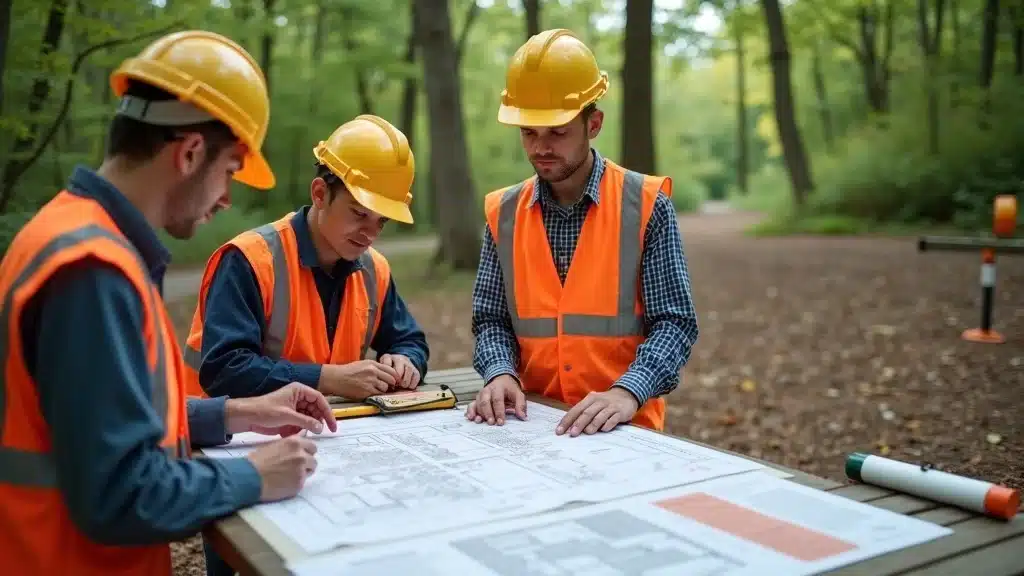
The quality, accuracy, and reliability of your existing condition survey hinges on the expertise of the land surveyor you hire. Licensed, experienced professionals may charge higher fees but deliver compliant, detailed, and respected survey reports. Less experienced or unlicensed providers sometimes offer lower prices, but the risks—from inaccurate measurements to rejected permit applications—almost always outweigh minor savings. Verifying your surveyor’s credentials, insurance, references, and local experience is an investment in peace of mind, helping you avoid more expensive corrections and disputes down the line.

Average Cost of Existing Condition Survey in Massachusetts

Recent Survey Cost Data and Real Examples

Massachusetts survey costs have risen in recent years, reflecting higher demand, stricter regulatory requirements, and increased labor expenses. Today, a typical existing condition survey for a single residential lot might cost $1,200 to $2,000, depending on size and documentation needs. For multifamily, commercial developments, or complex sites, prices rise to $2,500 – $3,500 or more. Ask your surveyor for recent examples, including what was included in each package, to benchmark your quote accurately. Knowing these cost ranges empowers you to evaluate quotes critically and understand what contributes to higher or lower pricing.

“The average cost of a land survey in Massachusetts can range significantly—from $800 to over $3,000 based on property and project details.” – Local Land Surveyor

What Affects the Average Cost for Land Surveys and Existing Condition Surveys?

Beyond basic size and complexity, several factors can affect the average cost of a land survey in Massachusetts. Detailed documentation, such as digital CAD files or extra map layers, can drive up the price. If a property has legal disputes, missing markers, or requires extensive historical deed research, surveyors may charge more due to added labor. Rush jobs or short-notice requests often come with premium fees. Conversely, well-documented sites with easy access, clear paperwork, or a previous recent survey may qualify for lower rates. Always ask your land surveyor to break down what’s included in their survey report and to itemize any recommended additional services to avoid surprise charges.

How to Avoid Overpaying for Existing Condition Survey Massachusetts Cost

  • Request multiple quotes from certified surveyors
  • Understand what is included in the survey report
  • Ensure completion of all required survey types
  • Consider future real estate transaction needs

One of the best ways to avoid overpaying is to request at least three quotes from qualified, local Massachusetts land surveyors. Each quote should break down what survey type is included, the scope of deliverables, and the time frame. Be wary of unusually low bids that may skip key details or use outdated techniques. Clarify exactly what is included—such as marked property boundaries, digital maps, or annotated CAD files. If you anticipate a future real estate transaction, plan for a survey with sufficient detail to satisfy banks, buyers, or municipal officials, so you don’t need to pay again later for missing documentation. Always choose licensed, insured professionals whose work is recognized by Massachusetts municipalities and lenders.

Watch:

People Also Ask: Existing Condition Survey Massachusetts Cost

How much does a property survey cost in Massachusetts?

The cost range for a property survey in Massachusetts varies based on property size, survey type, and project details, but most residential surveys typically cost between $800 and $2,500. Complex commercial, multi-acre, or existing condition surveys may push the price to $3,500 or higher. Request detailed, written quotes to understand what’s included and compare local options.

How much should you pay for a survey?

You should expect to pay a fair rate that matches your property’s complexity and survey requirements. For basic residential lots, $1,200 – $2,000 is typical. For more complex or commercial sites, costs may be higher. Always verify your land surveyor’s experience and ask what survey types your municipality or lender requires before hiring.

Who typically pays for the cost of a survey?

In most Massachusetts real estate transactions, the buyer is responsible for ordering and paying for a new property survey—especially if lenders require an updated survey report for financing or insurance. However, some sellers may provide recent survey documentation to speed up closing or resolve disputes. Always confirm survey requirements and payment responsibilities in your sale or development agreement.

What is the cheapest type of land survey?

The most affordable land survey is usually a basic boundary survey, intended solely to define property lines without detailed feature mapping or topography. These surveys can cost as little as $700 to $1,200, depending on the lot size and existing documentation. The scope and accuracy of the report should always match your planned use, as opting for the cheapest option may result in costly issues later if additional data is required.

Comprehensive FAQ: Navigating Land Survey Costs in Massachusetts

Friendly Massachusetts land surveyor team outside their office, ready to discuss existing condition survey Massachusetts cost

  • What drives the cost of a survey in Massachusetts?
    Property size, complexity, surveyor experience, survey type, local regulations, and the time of year all impact land survey costs.
  • Can existing condition surveys reduce real estate risk?
    Yes. These comprehensive surveys reveal issues before they disrupt projects or sales, helping to avoid legal, financial, or construction complications.
  • Are there state-wide requirements for land survey in Massachusetts?
    Yes. Massachusetts municipalities and state authorities have specific documentation and procedural requirements for permitting, real estate transactions, and property record keeping; always use a licensed professional familiar with your area.

Discover:

Key Takeaways for Existing Condition Survey Massachusetts Cost

  • Existing condition surveys protect your investment during estate transactions and construction
  • Average cost depends on type, size, and surveyor expertise
  • Compare surveyor quotes to avoid overpaying
  • Regulatory requirements can impact survey costs significantly

Ensure the Right Price: Next Steps for Your Existing Condition Survey in Massachusetts

Conclusion: Don’t let your project get derailed by unseen costs. Get the right existing condition survey—at the right price—by staying informed and working with trusted professionals.

If you’re ready to take the next step in safeguarding your property investment, there’s even more to explore about Massachusetts land surveying and civil engineering. The team at Mass Land Surveying offers a wealth of expertise, from in-depth survey guidance to advanced engineering solutions tailored for local regulations and unique site challenges. Whether you’re planning a residential build, a commercial development, or simply want to understand your property’s full potential, their comprehensive approach can help you navigate every phase with confidence. Discover how a strategic partnership with experienced professionals can streamline your project and deliver lasting value by visiting Mass Land Surveying’s Massachusetts land surveying and civil engineering resource.

Sources

Understanding the costs associated with existing condition surveys in Massachusetts is crucial for property owners and developers to avoid unexpected expenses. According to Millman Land, the cost of hiring a land surveyor in Massachusetts varies based on property size, project complexity, and the type of survey needed. For instance, boundary surveys typically range from $600 to $2,000, while ALTA/NSPS surveys can cost between $1,500 and $5,000 or more, depending on the level of detail required. (millmanland.com)

In urban areas like Boston, the average cost for a land surveyor ranges from $562 to $730, with potential variations from $303 to $1,138. These estimates are based on actual data from completed projects and are valid through early 2026. (homeyou.com)

It’s important to note that factors such as property size, terrain complexity, and local regulations can influence survey costs. Therefore, obtaining multiple quotes from certified surveyors and understanding the specific requirements of your project can help in managing expenses effectively.

Two construction workers in safety gear use surveying equipment on a dirt road at a construction site, with one adjusting a tripod-mounted device and the other holding a smartphone.

Land Survey for Construction: Don’t Start Without This Step Lakeville, MA

Startling Fact: According to the Massachusetts Board of Registration of Professional Engineers and Land Surveyors, over 50% of construction project delays are due to inadequate land survey planning and documentation. Whether you’re a homeowner planning an addition or a developer breaking ground on a major site in Lakeville, the very first step in the construction process isn’t design or permits—it’s securing an accurate, compliant land survey for construction. Skipping this step risks costly red tape, neighbor disputes, and project setbacks. This guide demystifies the process, illuminates the Massachusetts-specific requirements, and shows you how to set your project up for success from day one.

Why a Land Survey for Construction is Non-Negotiable in Massachusetts

  • The role of accuracy, compliance, and project enablement in MA construction projects
  • Local regulatory risks: How skipping a land survey exposes you to zoning, wetlands, and permitting issues

The foundation of every successful construction project in Massachusetts is an authoritative, up-to-date land survey for construction. In a regulatory environment as demanding as Massachusetts, accuracy isn’t a suggestion—it’s a mandate. An expertly executed construction survey underpins your design plans, verifies property lines, and helps secure permits. Without it, you could face delays, expensive redesigns, or even project shutdown by the local building department. Contractors, engineers, and owners all rely on this survey to plan, budget, and execute their work. In fact, with wetlands, historical overlays, and tight zoning controls common in Lakeville, the risk of launching without a comprehensive survey isn’t just inconvenience—it’s existential for your project timeline and bottom line.

Local regulations—especially around wetlands, floodplains, Title 5 septic, and stormwater—increase the stakes. Inadequate surveys can leave you exposed to costly stop-work orders, neighbor disputes, or lawsuits about property lines and encroachments. Ultimately, skipping the land survey for construction phase means introducing unnecessary risk into every subsequent phase of your project, from permitting through to final occupancy.

“A comprehensive land survey is your project’s foundation—without it, every step forward is a risk.” — Principal Surveyor, Mass Land Surveying

What You’ll Learn in This Guide to Land Survey for Construction

  • Key fundamentals of land surveying and its phases
  • Massachusetts land survey requirements for construction
  • Common pitfalls—and how to avoid costly mistakes
  • How to choose the right land surveyor for your Lakeville project
  • Step-by-step construction survey process explained

This guide delivers the practical knowledge you need to confidently navigate the land survey for construction process in Lakeville, Massachusetts. Loaded with regional expertise, it covers the key types of surveys, breakdown of deliverables, pricing insight, compliance requirements, and actionable steps to de-risk your real estate investment or construction project.

Understanding the nuances of each survey type is crucial for a smooth project. For a deeper dive into the differences between boundary, topographic, and construction surveys—and how each supports your project’s success—explore the comprehensive resources available at Mass Land Surveying’s Massachusetts Land Surveying & Civil Engineering hub.

Professional land surveyors on a construction site using total station and GPS equipment for land survey for construction in Lakeville, MA

Understanding Land Survey for Construction: Definitions & Process

  • What is a land survey for construction? Definition and purpose
  • How construction surveys differ from boundary, topographic, and mortgage surveys
  • Why every construction project (residential or commercial) in Lakeville requires a tailored land survey

A land survey for construction is a precise, legally-defensible mapping of your project site. It identifies property lines, topography, control points, and other critical data that underpin design plans and permit applications. What sets construction surveys apart from other types of land surveys—like boundary surveys, topographic surveys, or mortgage surveys—is their focus on supporting the entire construction process, from layout staking to as-builts. In Lakeville, every new build, addition, or renovation must comply with Massachusetts and local regulations, making a tailored survey not just recommended but essential for both residential and commercial developments.

Expert land surveyors coordinate closely with civil engineers, architects, and regulatory bodies to deliver specifications tailored to varying site conditions, permitting requirements, and intended use (from a custom home to a multi-lot subdivision). Skipping or inadequately executing this step exposes your project to potential risks like boundary disputes, misaligned foundations, wetland violations, and expensive corrections. The upfront investment in a high-quality construction survey ensures your design plan matches realities on the ground and that your project proceeds smoothly through local approvals.

Comparison of Types of Land Surveys Used in Massachusetts Construction Projects
Survey Type Purpose Key Deliverables Required For
Boundary Survey Defines property lines; resolves legal boundaries Metes and bounds descriptions, property corners marked Permitting, property transfers, dispute resolution
Construction Survey Guides construction layout and compliance Staking of building corners/control points, “as-builts” All types of construction projects
Topographic Survey Maps surface features and elevation Contours, spot elevations, site plan overlays Design plans, stormwater management, permitting
ALTA/NSPS Survey American Land Title Association-compliant for title insurance, commercial real estate Boundary, improvements, encroachments, easements Commercial real estate transactions, lender requirements

Key Types of Land Surveys Used in Construction Projects

Boundary Survey: Defining Your Property Line with Precision

  • Purpose: Avoiding disputes and legal challenges
  • Massachusetts legal standards for boundary surveys

When it comes to boundary surveys, precision is everything. A boundary survey determines exact property lines, identifying corners and demarcations according to Massachusetts legal requirements and GIS data. These surveys are critical for avoiding disputes with neighbors, ensuring compliance in setbacks, and obtaining clean title for any real estate transaction or construction project. Massachusetts law mandates boundary surveys for most construction permitting, especially when building near property lines or existing improvements. Land surveyors employ advanced GPS, total stations, and thorough land title research to avoid ambiguous parcels or encroachments, protecting owners from future litigation and forced revisions.

With frequent changes in local regulations and the prevalence of historic parcels in Lakeville, an expert surveyor ensures that all boundary lines are established to the highest accuracy. The deliverable—a stamped, legal survey plan—serves as your evidence in any zoning hearing, title company review, or neighbor negotiation.

Topographic Survey: Capturing Site Features that Impact Design

  • Why topography matters for permitting and design plans
  • Typical deliverables (site plans, contours, spot elevations)

A topographic survey is essential for designing site improvements, stormwater management systems, and foundations that comply with Massachusetts building code and wetland protection standards. Unlike a simple property line survey, topographic surveys provide a detailed map of the site’s elevations, contours, natural features, and man-made structures. Permitting authorities in Lakeville require these surveys for most development proposals, especially those affecting drainage or grading. Deliverables typically include site plans with elevations, contour maps, and overlays that guide architects and engineers as they design your project’s infrastructure and landscape integration.

Topographic data informs the locations for utilities, driveways, and structures, and supports civil engineering calculations. It also helps identify protected wetlands, flood zones, and other environmental constraints that will affect your design plan and permitting process.

Aerial view of a property being surveyed with survey markers and boundary flags visible for land survey for construction in Lakeville, MA

Construction Surveys: Laying Out Your Project for Success

  • Staking building corners, utilities, and control points
  • Integrating the construction survey results with design plans

The construction survey is the critical translation piece between design plans and physical reality. Once your design plan is approved, surveyors lay out the precise locations of building corners, utility connections, and control points—physical markers used by builders and civil engineers to ensure every element is installed to specification. They work closely with contractors to stake out foundations, roads, and infrastructure, reducing the likelihood of costly errors or misaligned builds. Deliverables often include “as-built” surveys that confirm every element has been placed according to plan—a requirement for final inspection and occupancy certification in Massachusetts.

Integrating the construction survey’s data with your design plans enables architects, engineers, and construction managers to monitor progress and identify issues in real-time. This integration saves time, minimizes rework, and protects your budget.

ALTA Surveys and Mortgage Surveys: When Are They Required?

  • Lender and title requirements in Massachusetts
  • How ALTA surveys add value for commercial projects

ALTA/NSPS surveys (developed by the American Land Title Association) are the gold standard for commercial real estate and some high-value residential projects. Lenders, title companies, and the American Land Title Association often require these comprehensive surveys to document boundaries, improvements, encroachments, and easements. For any commercial construction project in Lakeville, an ALTA survey can prevent disputes, ensure clean land title, and facilitate permitting. Mortgage surveys, meanwhile, are a more basic version appropriate for refinancing or property sale—they confirm that improvements are within boundaries and identify any encroachments, but they may not meet the higher standards required for construction start.

Choosing the type of survey that aligns with your project’s risk, lender requirements, and long-term objectives is essential—missing this step can stall closings or permit approvals, leading to delays and higher costs.

Massachusetts Compliance: Essential Standards for Land Survey for Construction

  • Permitting: How a compliant land survey streamlines approvals
  • Massachusetts Wetlands Protection Act and survey implications
  • Building near floodplains, septic requirements, and stormwater standards

Compliance in Massachusetts means more than just accurate measurements; it means following the Wetlands Protection Act, meeting floodplain and stormwater requirements, and working within the local zoning regulations. Any construction project near wetlands, streams, or floodplains requires a land surveyor to map resource area boundaries and apply the correct setbacks. Similarly, Title 5 septic systems, stormwater BMPs, and Conservation Commission site approvals all demand survey documentation as part of their regulatory checklist.

An accurate, professionally prepared land survey for construction streamlines approvals by providing authorities with the information they need to evaluate your project efficiently. Mistakes or omissions can result in rejected applications, enforcement actions, or mandatory redesigns, all of which add months and dollars to your budget. Working with a surveyor deeply familiar with Massachusetts codes ensures every plan meets agency expectations the first time, drastically reducing risk and time to permit.

“Compliance with local MA ordinances is not optional—it’s critical to project success and longevity.” — Project Manager, Mass Land Surveying

Land surveyor with GPS rover marking wetland boundary near a construction site in rural Massachusetts for land survey for construction

Land Survey for Construction Workflow: Step-by-Step Guide

  1. Pre-survey research: Title review and utility mapping
  2. On-site fieldwork: Marking control points, measuring boundaries
  3. Data analysis and CAD drafting: Generating deliverables for design plans
  4. Client review and regulatory documentation submission

The land survey for construction follows a methodical process to ensure accuracy, compliance, and full project enablement. It begins with a deep dive into the property’s history, including land title, deeds, and prior surveys, as well as utility maps. Experienced surveyors then head into the field, establishing control points and marking key boundaries using advanced equipment. This ensures all subsequent work is referenced against the immovable “anchors” of the site.

Back at the office, surveyors analyze the data and prepare digital deliverables in CAD or GIS formats, providing vital inputs for your design plan, permit applications, and construction layout. Finally, all survey documents are reviewed with the client (and often their architect, civil engineer, or builder) before being submitted to regulatory authorities for approval. This seamless workflow is what ensures your Lakeville project moves forward without a hitch.

Deliverables: What You Get from a Land Survey for Construction

  • Site plans, boundary maps, and topographic drawings
  • Digital deliverables (CAD, GIS) for architects and engineers
  • Staking and as-builts for construction layout
  • Legal documentation for permits and lenders

The output of a land survey for construction is more than just a map—it’s a suite of professional documents that guide your entire project and protect your investment. Expect clearly labeled site plans, boundary maps marking property lines and encumbrances, and topographic drawings that feed directly into your civil engineering and architectural designs. Digital CAD or GIS files allow your project’s professionals to overlay designs, update plans in real time, and meet the complex requirements of modern permitting.

On the ground, staking ensures that builders know exactly where to dig, pour, or install, dramatically reducing the risk of expensive mistakes. As-built surveys record the true positions of improvements once constructed, providing value for both compliance and future property transactions. Every deliverable is tailored to local requirements and lender expectations, ensuring nothing is missed in your final approvals.

Typical Land Survey Deliverables for Massachusetts Construction Projects
Deliverable Description Used By
Site Plan Shows structures, setbacks, easements, wetland/floodplain areas Architects, Civil Engineers, Contractors, Regulators
Boundary Map Documents metes and bounds, property markers Lawyers, Title Companies, Buyers
Topographic Drawing Elevation lines, spot grades, visible and underground features Design teams, Permitting Authorities
Construction Staking Physical markers for building corners, control points Contractors, Construction Managers
As-Built Survey Documents location of completed improvements Inspectors, Owners, Lenders
Digital GIS/CAD Files Layered drawing files to support further design and approvals Engineers, Municipal Reviewers

Architect reviewing land survey for construction plans in a modern office, displaying CAD drawings and site plans for Lakeville, MA

How Accurate Land Survey for Construction Prevents Costly Delays and Legal Issues

  • The true cost of errors: Construction delays, redesigns, legal conflicts
  • Local Lakeville case studies: Projects that succeeded vs. projects that stalled
  • How Mass Land Surveying’s QC process reduces risk at every phase

Mistakes at the surveying stage can cost Lakeville projects millions in change orders, neighbor disputes, and regulatory penalties. An inaccurate or incomplete land survey for construction may lead to incorrectly sited buildings, forced redesigns, or stop-work orders that stall your construction process and jeopardize financing. In the past decade, several projects in Massachusetts have experienced year-long delays or lawsuits solely due to errors in property lines or misidentified wetland boundaries. On the flip side, those that engaged professionals like Mass Land Surveying early in the workflow have consistently sailed through permitting, construction, and inspections on time and within budget, with strong land title records and happy neighbors.

Mass Land Surveying employs a rigorous quality control process—double-checking all measurements, reconciling survey data with historic records, and utilizing the latest digital technologies. This approach reduces the risk of missed details, disputed boundaries, or code violations, protecting your investment at every phase of your project. Don’t trust your project’s success to shortcuts—survey right, and build right from the start.

“Sloppy surveys cost builders millions every year in change orders and neighbor disputes.” — Civil Engineering Consultant, Boston

Lakeville contractor and surveyor discussing site layout with digital tablet for land survey for construction

Choosing a Land Surveyor for Construction in Lakeville: What to Look For

  • Licensing and credentials in MA
  • Experience with local terrain and regulatory bodies
  • Technical proficiency: Advanced surveying equipment and digital integration
  • Client coordination—responsiveness, timelines, and deliverable quality

Selecting the right land surveyor for your construction project in Lakeville is as crucial as choosing your architect or builder. Only a Massachusetts-licensed professional can stamp survey deliverables for permit submission. Prioritize firms with demonstrable experience in the Lakeville area; they’ll understand local zoning, wetlands mapping, and the nuances of regulatory review unique to Plymouth County. Review their technical prowess—are they using state-of-the-art GPS and laser equipment? Can they integrate survey data digitally into your architect or civil engineer’s design plan? And lastly, assess their client service: promptness, quality of deliverables, and willingness to stand behind their work if questions arise.

A trusted partner will guide you from early feasibility studies through construction layout, keeping your project on schedule and headaches to a minimum. Always check references, confirm licensing with the state, and request sample deliverables before making your selection.

Land Survey for Construction Pricing: What Should You Expect to Pay in Lakeville?

  • Factors influencing cost (lot size, complexity, type of survey, site accessibility)
  • Typical fee ranges for boundary, topographic, and construction surveys
  • Why cheaper is not always better: Avoiding low-bid pitfalls
  • Value of local expertise in pricing and speed

Cost for a land survey for construction in Lakeville varies widely based on your project’s complexity. Primary factors include lot size, shape, wooded vs. open terrain, accessibility, and the type of survey needed (boundary, topographic, construction staking, or ALTA survey). Simple residential boundary surveys typically run $800–$1,500, while more involved topographic or construction surveys can fall in the $1,500–$3,500 range or higher. If wetlands delineation or complex title research is needed, costs may increase based on required coordination with civil engineers, conservation commission reviews, or additional site visits.

Beware of low-ball offers. Underpriced surveys often cut corners, increasing the likelihood of mistakes, missed regulatory requirements, or costly mid-project revisions. Partnering with an experienced, regionally known surveyor like Mass Land Surveying may mean a slightly higher fee up front, but it pays dividends by reducing risk, delays, and change orders.

Sample Land Survey Costs for Construction Projects in Lakeville, MA
Survey Type Up to 1 acre 1–5 acres 5+ acres/complex
Boundary Survey $800 – $1,500 $1,500 – $2,500 $2,500+
Topographic Survey $1,200 – $1,800 $1,800 – $3,000 $3,500+
Construction Survey $1,200 – $2,000 $2,000 – $3,500 $4,000+
ALTA/NSPS Survey $2,500 – $4,000 $3,500 – $6,000 $8,000+

People Also Ask: Land Survey for Construction FAQs

Do I need a land survey before building?

  • Yes, Massachusetts requires a land survey for construction to establish property lines, secure permits, and avoid project delays or legal issues. Omitting this step risks significant compliance setbacks and increased costs.

If you plan to build in Lakeville, never skip the land survey. Permits require a stamped plan showing property lines, setbacks, wetland boundaries, and—if applicable—details tied directly to your proposed new structure. Unpermitted or incorrectly sited work not only delays your project but also places you at risk of legal action.

How much should you pay for a survey?

  • Costs for a land survey for construction in Lakeville typically range from $800 to $3,500, depending on lot size, terrain, and the type of survey required. Complex projects or those near protected areas may cost more due to additional compliance steps.

Invest for quality rather than just cost savings. A comprehensive, local survey is worth many times its price if it helps avoid expensive changes or compliance issues during your construction process.

What does a land survey consist of?

  • A thorough land survey for construction includes records research, on-site measurements (boundary, topographic, and control points), CAD mapping, and legal documentation. Results are used to establish property boundaries and guide construction layout.

Surveyors begin by researching your land title and previous surveys, then performing on-site measurements. Data is then analyzed to produce legal plans, site maps, and digital files compatible with design software. Physical markers and documentation tie the fieldwork directly to your project’s legal and construction requirements.

How much does a survey cost in New Jersey?

  • While pricing in New Jersey may be similar, this guide focuses on Lakeville and Massachusetts-specific requirements. For local pricing, consult a licensed surveyor in NJ.

This article is tailored for Lakeville, MA and the standards that govern construction here. Always use locally-licensed professionals for cost and compliance clarity.

Lists: Land Survey for Construction Checklist for Lakeville, MA

  • Confirm MA-licensed land surveyor involvement
  • Secure project site and property deeds
  • Clarify types of survey needed (boundary, topographic, construction layout, etc.)
  • Coordinate deliverable formats with your architect or engineer (CAD, GIS)
  • Review wetland, floodplain, and zoning constraints
  • Schedule all required pre-construction inspections and layout staking

Survey team reviewing project checklist for land survey for construction in Lakeville, MA

Key Takeaways: Why Every Lakeville Construction Project Needs a Professional Land Survey

  • A land survey for construction is not optional—it’s vital for compliance, design, and risk mitigation
  • Massachusetts standards are stringent: precision and local knowledge are non-negotiable
  • Correct surveys protect you from lawsuits, neighbor disputes, and expensive delays
  • Hiring a trusted local surveyor like Mass Land Surveying secures your project from day one

FAQs: Land Survey for Construction in Lakeville, MA

  • When should I schedule a survey in my construction timeline?
    As soon as you begin planning or before submitting for permits. Early surveys prevent design conflicts and can accelerate the construction process.
  • What deliverables should my surveyor provide?
    Expect site plans, boundary maps, topographic drawings, construction staking documentation, as-builts, and digital files (CAD/GIS) for project integration.
  • Are drone and GIS surveys accepted by Massachusetts regulators?
    Yes, when performed by a MA-licensed surveyor. Drones and GIS tools speed up data collection and offer improved accuracy, especially for large or complex lots.
  • How do I verify my surveyor’s license in MA?
    Visit the Massachusetts Board of Registration of Professional Engineers and Land Surveyors online to look up credentials by name or license number.

Sample Land Survey for Construction Deliverable: Site Plan Walkthrough

  • Annotated breakdown of a typical Lakeville, MA site plan deliverable
  • Key elements: property line, topographic features, setbacks, and wetland boundaries

Your survey deliverable will show property lines, contour elevations, structural footprints, building setback lines, and mapped environmental buffers. These annotated site plans serve as the bedrock document for design, permitting, and construction sequencing.

Conclusion: Plan Confidently—Start Every Construction Project with a Land Survey for Construction

  • Summarize the transformative value of professional surveying
  • Emphasize compliance, risk reduction, and project momentum

Partnering with a licensed surveyor transforms risk into confidence, ensures compliance, and keeps your project moving. Always start with a land survey for construction if you want precision, approvals, and peace of mind in Lakeville, MA.

If you’re ready to take the next step in your construction journey, consider exploring the broader landscape of land surveying and civil engineering services that can further streamline your project. From advanced site planning to integrated engineering solutions, Mass Land Surveying’s Massachusetts Land Surveying & Civil Engineering team offers the expertise and local insight to help you navigate every phase with confidence. Discover how a holistic approach to surveying and engineering can unlock greater value, reduce risk, and set your Lakeville project up for lasting success.

Get Your Land Survey Today — Trusted for Lakeville, MA Construction Projects

Sources

Ensuring your construction project in Lakeville, MA, starts on solid ground requires a comprehensive understanding of land surveying. The article “The Importance of Land Surveys for New Construction” by Fleis & VandenBrink highlights how precise surveys provide clarity for engineers, contractors, and owners, facilitating accurate and efficient building processes. (fveng.com) Additionally, the “Land Surveying Frequently Asked Questions” page by the City and County of Denver offers insights into the necessity of employing licensed land surveyors before construction to prevent potential legal issues and ensure compliance with local regulations. (denvergov.org) If you’re serious about laying a strong foundation for your project, these resources will equip you with the essential knowledge to navigate the land surveying process effectively.

Three construction workers in orange safety vests and yellow helmets review plans on a table in a forest, discussing a project surrounded by trees and dirt paths.

Surveying Company Near Me? Here’s How to Pick the Best Lakeville, MA

Startling fact: Did you know nearly 30% of Massachusetts development delays are due to land survey issues? Choosing the right surveying company near me is more critical than ever—mistakes in boundary lines, misunderstanding state regulations, or selecting an underqualified land surveyor could stall your project for weeks or cost you thousands. Whether you’re a homeowner, developer, or architect in Lakeville, MA, making the right call means ensuring accuracy, total compliance, and proper approvals—without headaches or red tape. This guide will clarify what sets top land surveyors apart and equip you to choose the surveying company near me that keeps your project on track and risk-free.

Startling Fact: Why the Right Surveying Company Near Me Matters More Than Ever

Did you know: Nearly 30% of Massachusetts development delays are due to land survey issues?

Development in Lakeville and across Massachusetts hinges on accurate, regulatory-compliant land surveys. A seemingly simple boundary dispute, an overlooked wetland, or a misinterpreted topographic survey can derail real estate closings, trigger permit denials, or invite costly redesigns. In Lakeville, where zoning overlays, conservation commissions, and community interests intersect, your choice of surveying company near me determines whether your project advances or stalls. Statistically, more than a quarter of local development delays trace back to inadequate or inaccurate land survey work.

This underscores a painful truth: Not all surveying companies operate at the same level of technical mastery or local compliance. The best Massachusetts-licensed land surveyor brings more than just measurement precision—they interpret state land use statutes, collaborate with town boards, and leverage technology like GPS total stations and digital mapping. By investing in the right surveying company near me, you’re not just purchasing a plan; you’re reducing legal risks, avoiding boundary disputes, and safeguarding your entire investment.

Professional land surveyors in Lakeville, MA reviewing detailed site plans and boundary maps at an outdoor project site. Surveying company near me demonstrates accuracy and local expertise—woodland edges, survey markers, and high-visibility vests visible.

What You’ll Learn About Hiring a Surveying Company Near Me

  • How to recognize a qualified land surveyor for your project
  • The importance of compliance with Massachusetts regulations
  • Factors that should influence your surveying company near me decision
  • Survey cost breakdowns—from site boundary survey to topographic survey
  • Key differences between surveying companies in Lakeville, MA

When considering which surveying company to hire, it’s helpful to understand the full range of services and expertise available in your area. For a deeper look at the specialized land surveying and civil engineering solutions offered locally, you can explore the comprehensive overview provided by Mass Land Surveying’s Massachusetts land surveying and civil engineering services, which details their approach to accuracy, compliance, and project support.

Why Accuracy and Compliance from a Surveying Company Near Me Are Non-Negotiable

“Hiring a surveying company near me that specializes in Massachusetts regulations minimizes risk, maximizes accuracy, and keeps your project moving forward.”

Accuracy isn’t just a technical goal—it’s a legal imperative. A Massachusetts land surveyor’s error can trigger disputes over property boundaries, force expensive changes in site designs, or even invalidate your permit applications and real estate closings. Compliance is equally vital: Local agencies (including the Lakeville Conservation Commission, Building Department, and Board of Health) review every submission for regulatory adherence, such as the Massachusetts Wetlands Protection Act or FEMA floodplain requirements.

When you partner with a premier surveying company near me, you receive more than lines on a paper. You gain peace of mind that your boundary survey or topographic survey stands up to intense municipal scrutiny. These companies use advanced equipment—like robotic total stations and 3D mapping drones—to achieve the highest quality and level of accuracy. Beyond technology, selecting a company fluent in Massachusetts and Lakeville-specific regulations delivers results that move your project seamlessly from design to approval.

Surveying Company Near Me: Core Service Offerings in Lakeville, MA

Land Survey and Boundary Survey: Defining Property Boundaries with Precision

  • ALTA/NSPS Land Surveys
  • Boundary surveys for real estate transactions
  • Subdivision plans and property lines
  • Wetlands delineation and compliance checks

A boundary survey determines the official property lines, which is crucial during real estate deals, construction, and permitting. In Lakeville’s wooded neighborhoods and waterfront lots, clear property boundaries prevent encroachment disputes and provide our clients with legal documents needed for zoning or sales. ALTA/NSPS standards often come into play for commercial sites, ensuring legal compliance during property transfers. Wetland delineation is increasingly common, where surveyors identify protected areas under Massachusetts law—a step critical for st ste, church st, and anywhere near conservation land or floodplains. Choosing a surveying company near me that delivers complete, accurate, and regulation-compliant plans is the safeguard your project needs.

Subdivision scenarios, whether splitting a family lot or developing new housing, require surveyors to map out parcels, mark every corner, and prepare filings for town approval. The best land survey companies in Lakeville, MA, provide you with not just maps, but insight—flagging zoning risks, managing public hearings, and making legal property boundaries clear for buyers, sellers, or town staff. This level of deliverable quality distinguishes true professionals from basic property surveyors.

Detailed suburban property boundary markers and survey stakes in a Lakeville, MA neighborhood. Crisp property corners highlight boundary survey results by a surveying company near me.

Land Surveying for Developers, Architects, and Contractors

  • Topographic surveys for site design
  • Construction layout and as-builts
  • FEMA Floodplain and Conservation Commission deliverables
  • GIS/CAD data integration and utility mapping

Projects led by architects, developers, and contractors in Lakeville, MA demand land surveying services that are far more than simple measurement. Topographic surveys provide elevation data, contour mapping, and documentation of critical site features—like wetlands, utilities, and road frontages. These plans form the essential base for civil engineers, site designers, and stormwater modelers. Construction layout services translate engineered plans into precise coordinates on the ground, enabling crews to build within approved limits.

For complex projects—such as subdivisions along Lake Assawompset or new commercial builds near bustling town corridors—surveyors in the surrounding area must deliver custom GIS and CAD files, as-builts for municipal signoff, and FEMA Floodplain data to minimize flood risk and ensure insurability. Top surveying companies commit to high-quality, precise results—using technology like GPS, drone photogrammetry, and CAD integration—so developers, architects, and contractors can keep projects on time and in compliance with state and local requirements. If you’re searching for a surveying company near me, prioritize those who support your project at every regulatory and construction step.

How to Evaluate a Surveying Company Near Me: Credentials, Reviews, and Local Expertise

  • Licensed Massachusetts land surveyor credentials
  • Project references in Lakeville and surrounding towns
  • Sample deliverables: site plans, boundary certificates, as-builts
  • Client testimonials and local authority status

Evaluating a surveying company near me requires more than browsing websites. First, confirm all surveyors hold a current Massachusetts license—this is a non-negotiable legal standard for boundary survey, topographic survey, and all types of land surveys. Next, insist on seeing real project references from Lakeville and surrounding area neighborhoods; these show that the company can deliver results and navigate local nuances. Ask for example deliverables, including recent site plans, boundary certificates, or as-built surveys—they should be clear, annotation-rich, and tailored to Massachusetts and Lakeville regulations.

Last but not least, scrutinize testimonials and confirmed local authority status. Top land surveyors are often recognized by area real estate attorneys, architects, and municipal staff. Read client reviews, but also check town board minutes and permit records for evidence of reliable, complaint-free work. A credible surveying company near me will stand out through consistent, high-quality outcomes and visible relationships with Lakeville regulators. Remember, the right surveyor not only maps your property; they enable your land use goals while keeping you compliant and stress-free.

Modern professional land surveyor holding a survey instrument in front of a Lakeville, MA municipal office. Surveying company near me emphasizes licensed MA credentials and local expertise.

Land Surveyor Cost Table: What to Expect When Booking a Surveying Company Near Me

Survey Type Average Cost (Lakeville, MA) Typical Timeframe Included Deliverables
Boundary Survey $800-$1,500 1-2 weeks Legal plan, marked corners
Topographic Survey $1,200-$2,500 2-4 weeks Elevation map, contours, site features
Subdivision Plan $2,000-$4,000+ 3-6 weeks Full subdivision plan, compliance review
Wetland Mapping $1,200-$2,000 2-3 weeks Wetlands delineation, regulatory notes

Survey cost depends on several factors—the size and terrain of your lot, project complexity, regulatory requirements, and required deliverables. For example, a simple boundary survey for a small Lakeville parcel may be at the lower end, while topographic survey for a large development with wetlands and utilities will cost more. Always confirm what’s included: legal plans, digital files, site staking, or compliance packets for conservation submissions. High-quality land surveys may seem like an upfront investment but routinely prevent boundary disputes, permit denials, and construction changes, saving you survey costs in the long run. Be sure to request transparent, itemized pricing from any surveying company near me before signing on.

The Surveying Company Near Me Checklist: 7 Must-Ask Questions Before You Hire

  1. Is your surveying company licensed in Massachusetts?
  2. Have you completed land surveys in Lakeville, MA before?
  3. What is your typical boundary survey workflow?
  4. How do you ensure accuracy and compliance with property boundaries?
  5. Can you handle wetland delineation and stormwater mapping?
  6. What is your turnaround time for deliverables?
  7. How are survey costs calculated and communicated upfront?

Hiring a surveying company near me in Lakeville isn’t just about lowest price or fastest promise. You need assurance of Massachusetts licensure, direct experience in your neighborhood (or type of property line), and a transparent workflow for your type of land survey. Ask pointedly about their process for staking property boundaries, mapping wetlands if relevant, and how they keep up on evolving state and federal requirements. Request an explicit breakdown of what’s included in each quote to avoid surprises—complex projects can quickly scale in cost if obligations, like conservation notices or FEMA floodplain reviews, are missing up front. These seven questions de-risk your choice and guarantee you select a surveyor who’s equipped to deliver results for your specific Lakeville property.

Video Overview: Watch as a Massachusetts-licensed land surveyor completes a new Lakeville site survey, from precise GPS measurements to deliverable review with a property developer. The video highlights checkpoint approvals, real-time data gathering with total stations, and a consultative approach that ensures every land survey stands up to both engineering and regulatory review in Massachusetts. Notice the professionalism, clarity in site plan explanation, and handshake—the signs of a thorough, compliant survey partnership.

People Also Ask: Surveying Company Near Me

How much do surveyors charge per hour?

The hourly rate for a land surveyor in Lakeville, MA is typically between $125 and $250, depending on the complexity of the job and the experience level of the professional. Factors like the need for advanced total stations, difficult terrain, and urgent timelines can affect the price. Always request detailed quotes that clearly state whether administrative fees, travel, or compliance paperwork are included. Transparency on survey cost upfront helps avoid any billing disputes and ensures that you receive the highest quality service without unexpected expenses down the line.

Modern survey team using GPS equipment and tablets on a semi-rural Massachusetts lot. Surveying company near me exemplifies team collaboration, digital accuracy, and local project understanding.

How much is the cost of a surveyor?

For most properties in and around Lakeville, you can expect to pay between $800 and $2,000 for standard land surveys. The final survey cost will depend greatly on the type of survey (e.g., simple boundary survey vs. full topographic survey), property size, and specific deliverables needed for real estate or municipal compliance. Complex or multi-parcel boundary surveys and wetlands work can push costs significantly higher due to added research, fieldwork, and regulatory paperwork. Choosing a surveying company near me that provides detailed quotes and communicates clearly will help you budget confidently and avoid surprises.

Is it worth paying for a survey?

Absolutely. A land survey acts as your project’s insurance policy—protecting you from legal disputes, permit issues, and expensive construction changes down the road. For both homeowners and developers, investing in a qualified surveying company near me delivers results that prevent boundary confusion and support property value. In Massachusetts, where compliance and documentation are strictly enforced, the right land surveyor validates your property rights, clarifies use restrictions, and helps deliver results that streamline design, approval, and construction. Skipping or underestimating this step risks far costlier headaches in the future.

How much does it cost for a building surveyor?

Building surveyors, who inspect structures and site improvements, often charge between $1,000 and $3,000 for residential jobs in Lakeville. If the work includes zoning compliance, historical research, or as-built recording for permit sign-off, costs can increase based on the extent of documentation required. When choosing a surveying company near me for building surveys, be sure to ask for examples of previous work and make sure they’re accustomed to Lakeville-area code requirements as well as Massachusetts building and environmental laws.

Why Mass Land Surveying Is the Top Surveying Company Near Me in Lakeville, MA

  • Massachusetts-licensed professional land surveyors
  • Decades of local experience with land surveys, property boundaries, and permitting
  • State-of-the-art technology for survey accuracy
  • Personalized consultation for homeowners, developers, and architects
  • Clear, up-front pricing and regulatory compliance guarantee

Mass Land Surveying is more than a vendor—they’re your trusted Massachusetts site development authority. Their team exclusively employs Massachusetts-licensed land surveyors with deep, hands-on experience in the Lakeville area. Prime’s use of advanced tools—total stations, GPS, laser scanning, and drone photogrammetry—ensures all deliverables meet the highest quality and level of accuracy demanded by local permitting boards, architects, and engineers. Clients speak highly of both the process (collaborative, clear, always on schedule) and results (regulatory-compliant plans that get immediate approvals). Unlike generic survey companies, Prime tailors every step—from site walk to digital plan delivery—to local codes, Lakeville planning board requirements, and your project’s specific needs. If your goal is a worry-free property or development experience, you’ll find Prime’s consultative, compliance-first approach sets them apart as the surveying company near me to trust.

Technologically advanced surveying company near me: 3D laser scanner and drone used for site analysis in Lakeville, MA. Local expertise and state-of-the-art methods set Mass Land Surveying apart.

Video Summary: See the step-by-step client journey after reaching out to a surveying company near me: site assessment, proposal review, field survey using total stations and drone equipment, plan drafting, compliance checks, and a final meeting where survey results are explained in plain English. This transparent, collaborative process means no confusion, no surprises, and a clear path toward project success in Lakeville, MA or across the South Shore region.

Key Takeaways: How to Choose the Right Surveying Company Near Me

  • Prioritize accuracy, compliance, and local expertise
  • Always request Massachusetts-specific credentials
  • Review local project examples and deliverable quality
  • Compare survey cost estimates transparently

Welcoming consulting session: land surveyor and Lakeville homeowner reviewing property boundary plans in a bright, modern kitchen. Consultative, client-focused approach of top surveying company near me.

Frequently Asked Questions About Surveying Company Near Me

  • What documents do I need before hiring a surveying company near me?
    Gather your property deed, any historic surveys, town assessor’s map, and details on proposed site changes or construction. Having legal documents and clear goals ready will help your surveyor provide the most accurate, project-specific scope and costs.
  • How long does a typical land survey take in Lakeville, MA?
    Most boundary surveys and topographic surveys are completed within 1-4 weeks, depending on property size, complexity, and season. Wetland mapping or subdivision plans may take longer due to regulatory reviews and field verification. Ask your surveying company for a timeline based on local permitting cycles.
  • Will the surveying company near me assist with permit applications?
    Yes—top Lakeville survey companies provide application support, including site plans for town review, wetland delineation packets, and compliance certifications. They also consult with permitting boards or appear at public hearings to help keep your project moving forward.

Ready to Work With the Leading Surveying Company Near Me?

The right land surveyor accelerates approvals and maximizes project value. Get Your Land Survey Today with Mass Land Surveying—Lakeville’s expert for accuracy, compliance, and results.

Conclusion

Choose a surveying company near me that’s local, licensed, and focused on regulatory accuracy—your Lakeville project depends on it.

If you’re ready to take the next step in your property or development journey, consider broadening your understanding of how expert land surveying and civil engineering can transform your project’s outcome. By exploring the full spectrum of services and strategic insights available from a leading provider, you’ll gain the confidence to navigate even the most complex regulatory and design challenges. Discover how a partnership with a top-tier firm can streamline approvals, enhance site value, and future-proof your investment by visiting Mass Land Surveying’s Massachusetts land surveying and civil engineering resource. Unlock advanced solutions and set your Lakeville project up for lasting success.

Sources

When selecting a surveying company in Lakeville, MA, it’s essential to choose a firm with a strong reputation for accuracy and compliance. The Better Business Bureau (BBB) offers a comprehensive directory of land surveyors, allowing you to assess their ratings and customer reviews. This resource can help you identify reputable professionals in your area. (bbb.org)

Additionally, Bark.com provides a platform to connect with local qualified surveyors. By detailing your project requirements, you can receive free quotes from professionals, compare profiles, and read previous reviews to make an informed decision. (bark.com)

If you’re serious about ensuring your project’s success in Lakeville, MA, these resources will provide you with the necessary information to select a surveying company that meets your needs.

Two surveyors wearing caps and backpacks use yellow theodolites on tripods in a grassy field at sunrise, with trees and hills in the background.

Inside Look at Land Survey Equipment Revolutionizing Accuracy Lakeville, MA

Did you know? A single misplaced boundary marker in Massachusetts can cost homeowners and developers tens of thousands of dollars in legal fees or project delays. Today, land survey equipment delivers precision measured in millimeters, virtually eliminating these expensive setbacks. Discover the game-changing technology and expert insights enabling Lakeville, MA projects to meet the state’s strict regulatory standards—while staying on time and under budget.

Cutting-edge land survey team using total station and GNSS receiver in Lakeville MA, demonstrating advanced survey equipment accuracy in a rural Massachusetts landscape under soft morning light

Startling Advancements in Land Survey Equipment: A Data-Driven Look

A decade ago, most surveying equipment could measure distances to the nearest inch, but required hours in the field, manual data entry, and left room for human error. Today, robotic total stations, satellite-connected GNSS receivers, and touchscreen data collectors have transformed the industry. According to recent statistics, adopting these tools in Massachusetts has reduced survey turnaround times by up to 40% and boosted boundary survey accuracy to sub-centimeter levels—a standard now demanded by local boards and Conservation Commissions.

Smart automation is now core: modern survey equipment integrates directly with CAD/GIS software, allowing data to move seamlessly from the field to design teams. Advanced electronic distance meters and real-time GNSS receivers ensure surveys meet the elevation, boundary, and wetland proximity requirements unique to the Lakeville area. Whether you’re a homeowner considering an addition or a developer planning a subdivision, staying ahead with these technologies is no longer optional—it’s a necessity for compliance and cost control.

For those interested in a deeper dive into how these technologies are applied in real-world scenarios, you can explore a comprehensive overview of Massachusetts land surveying practices and equipment selection to see how local experts leverage these tools for maximum accuracy and regulatory compliance.

“Today’s land survey equipment delivers precision measured in millimeters—a leap that minimizes costly project errors.” —Mass Land Surveying Team

What You’ll Learn About Land Survey Equipment in Lakeville, MA

  • Which survey equipment and surveying equipment achieves the highest accuracy per Massachusetts standards
  • How total station, GNSS receiver, and data collector revolutionize site surveys
  • Key benefits of modern land survey technology for compliance and project approvals
  • How to select the best land survey equipment for your Lakeville-based project
  • Comparative insights for homeowners, architects, and developers needing survey equipment

Why Accuracy in Land Survey Equipment Matters for Lakeville, MA Projects

In Lakeville, the difference between passing an inspection and starting over often comes down to the accuracy of your land survey equipment. Massachusetts building codes, Conservation Regulations, and local wetland standards require pinpoint precision. Choosing equipment like a highly accurate total station or a calibrated GNSS receiver can mean the difference between fast project approvals or lengthy, costly, unexpected delays.

Technical mastery isn’t just for contractors. For homeowners, the right surveying equipment protects you from unwanted property disputes and ensures new buildings or additions don’t trespass protected wetlands or buffer zones. Developers and architects depend on reliable data collection for design and permitting—accuracy is not just a technical requirement, but a critical risk control for every Lakeville project.

From Zoning to Wetlands: Regulatory Precision with Modern Surveying Equipment

Lakeville, MA, like much of the state, is governed by strict environmental and zoning laws. Boundaries and setbacks must be certified with high precision to comply with conservation commission requirements and the Massachusetts Wetlands Protection Act. Instruments like total stations and GNSS receivers have made it possible to meet these demands, mapping out irregular lots, wetlands, and floodplain boundaries down to a few millimeters. This level of precision dramatically de-risks projects, reducing the potential for failed permits, Conservation Commission denials, or neighborhood disputes over property lines.

Did you know that Lakeville’s Conservation Commission often requires full digital documentation and periodic re-surveys for projects near wetlands? Modern survey equipment enables surveyors to deliver these required formats directly, cutting weeks from approval cycles and assuring compliance—even as regulations evolve.

Professional surveyor using advanced GNSS receiver by Lakeville wetland boundary, illustrating regulatory-compliant land survey equipment in Massachusetts wetlands

Impact of Land Survey Equipment on Site Development and Project Timelines

The role of advanced land survey equipment extends beyond compliance. For contractors and developers, accurate initial surveys speed up construction planning, staking, and site layout. Robotic total stations automate point collection, minimizing human error and enabling just one surveyor to cover large areas that used to require a full crew. Meanwhile, integrated data collectors and GNSS receivers feed results directly into digital site plans, accelerating approvals and handoffs between field and office.

When timelines shrink, so does cost exposure. One missed boundary marker or poorly aligned foundation can result in expensive rework. Using state-of-the-art surveying equipment in Lakeville ensures your project hits every milestone without expensive setbacks—whether you’re breaking ground on a subdivision or simply fencing your backyard.

Land Survey Equipment: Core Technologies Shaping the Industry

Behind every approved project in Lakeville is a suite of advanced surveying equipment—purpose-built for Massachusetts’ demanding terrain and regulatory needs. Here’s a look at how core technologies like total stations, GNSS receivers, and modern data collectors revolutionize accuracy, efficiency, and compliance for Lakeville land surveys.

From the robust durability required for unpredictable New England weather to the seamless integration with GIS/CAD systems, these tools ensure that every project, no matter the scale, stands on a foundation of measurable precision.

Total Station Innovations in Land Survey Equipment

Robotic total stations are at the forefront of modern surveying equipment. Unlike traditional instruments, they automate angle and distance measurement, track a surveyor’s prism, and wirelessly transmit data to field devices. For Massachusetts projects, particularly those in Lakeville with complex topography, total stations enable boundary surveys with sub-millimeter precision—making them indispensable for architects and engineers responsible for construction layout and as-built documentation.

Innovations such as integrated laser scanners and hybrid “one-man” operation give total stations unmatched site flexibility. Surveyors can now quickly and accurately measure distances, plot elevation, and log every detail—from utility easements to subtle grade changes. This is vital for both new builds and historic renovations where precision is key to regulatory approval and long-term property value.

Modern robotic total station mounted on tripod with detailed engineering site background, showcasing accurate land survey equipment for Massachusetts projects

GNSS Receivers: Enhancing Survey Equipment for Real-Time Data

Global Navigation Satellite System (GNSS receivers) represent a leap in survey equipment accuracy and speed. For land surveys in Lakeville, GNSS receivers can acquire real-time, centimeter-level position data—critical for property boundary surveys, grading plans, and FEMA floodplain determinations. Unlike older GPS units, advanced GNSS systems support Massachusetts coordinate systems and can maintain accuracy even under thick canopy cover or near wetlands.

In addition, features like RTK (Real-Time Kinematic) corrections and network integration make these units highly responsive. With multiple satellite constellations, surveyors can work in challenging Lakeville terrain, minimizing downtime and ensuring that site information flows instantly into planning and engineering workflows. This capability enables rapid project startup and consistent compliance with evolving state and local regulations.

Data Collectors: Streamlining Survey Equipment Workflow

A modern data collector is the nerve center of every survey team. These rugged, touchscreen devices integrate with total stations and GNSS receivers, running specialized software to support digital mapping, stakeout, and automated data logging onsite. For Lakeville surveys, a robust data collector ensures all field data is instantly uploaded to project files, reducing the risk of transcription errors and speeding data integration into CAD or GIS environments.

Newer models offer wireless data sync, integrated cameras, and geo-tagging, further enabling regulatory reporting. Their intuitive interfaces require minimal training, allowing surveyors (and even non-experts) to verify critical benchmarks for zoning, wetlands protection, and construction staking directly from the field in weather-resistant hardware.
Key features to compare:

  • Accuracy ratings
  • Field durability
  • Data integration benefits

Comparing the Best Land Survey Equipment for Lakeville, MA

Selecting the right land survey equipment is both a technical and a regulatory decision in Massachusetts. The following comparison highlights the primary options used in Lakeville, considering cost, compliance, and field accuracy:

Surveying Equipment Key Features Compliance (MA) Cost Accuracy
Total Station Robotics, Laser Yes $$$ <1mm
GNSS Receiver RTK, Durable Yes $$ 1-2cm
Data Collector Touchscreen, Wireless Yes $ Data quality

How Modern Surveying Equipment Ensures Massachusetts Compliance

Lakeville projects face some of the most stringent environmental and zoning requirements in the state. Modern land survey equipment is engineered to support automated reporting, direct data upload into mandated formats, and seamless integration with state coordinate grids. With total stations, GNSS receivers, and digital data collectors, surveyors guarantee deliverables that meet or exceed every point of compliance required by the Lakeville Planning Board and Conservation Commission.

These technologies de-risk permit applications, avoid costly survey redos, and ensure timelines are met—whether for a single-family home near wetlands or a major infrastructure development. Selecting compliant survey equipment is not just about accuracy, but about enabling your project to move smoothly from planning to approval and beyond.

Land Survey Equipment and Local Regulations

In Massachusetts, regulatory bodies demand survey deliverables in formats compatible with MassGIS, MassDEP, and Conservation Commission records. Only advanced survey equipment—integrated total stations, GNSS receivers, and certified data collectors—can reliably create the topographic maps, boundary documentation, and wetland delineations needed for a successful Lakeville project.

For wetlands and buffer zones, Lakeville inspectors may require annual recertification using compliant equipment. This underscores the need for specialized accuracy, robust data logging, and hardware built for MA regulatory workflows. By working with a team—like Mass Land Surveying—that leverages the best technology, you ensure permits are streamlined, documentation is accurate, and legal risks are fully minimized.

“Compliant land survey equipment helps avoid legal setbacks and ensures seamless permit approvals for Lakeville, MA sites.” —Massachusetts Civil Engineer

Essential Features to Look for in Survey Equipment

Not all surveying equipment can withstand the rigors of Massachusetts weather or meet local compliance requirements. When choosing technology for a Lakeville project, consider these must-have features:

Open survey equipment case with GNSS receiver and data collector, illustrating key survey equipment choices for compliance in Lakeville Massachusetts

  • Integrated data collector functionality
  • Precision GNSS receiver compatibility
  • User-friendly interfaces for field crews
  • Durability for Massachusetts weather

Ruggedness ensures your equipment won’t fail mid-survey, while intuitive design guarantees even non-engineers can avoid costly mistakes. Compatibility with digital platforms accelerates data transfer to architects, site planners, or regulatory agencies—delivering the speed and confidence required for successful, fully compliant projects.

Land Survey Equipment Reviews: Field Experience in Lakeville

What are Lakeville’s top surveyors saying about their equipment? Across dozens of local projects, Mass Land Surveying field teams have validated that investing in the right land survey equipment pays off in both compliance and time savings. Surveyors consistently note that robust total stations capture more data points with less effort, while modern GNSS receivers maintain their accuracy even near Lakeville’s dense tree lines and variable terrain.

Touchscreen data collectors have been especially praised by field crews, streamlining everything from stakeouts to digital mapping with just a few taps. The consensus: for Lakeville’s mix of open farmland, wetlands, and historic neighborhoods, only fully integrated, Massachusetts-compliant equipment ensures error-free deliverables and smoother approval processes.

Surveyors Assess Total Stations, GNSS Receivers, and Data Collectors

Lakeville field teams frequently report that advanced total stations and GNSS receivers make the biggest difference when it comes to tricky boundary survey work and topographic mapping. “One-person robotic total stations cut our field time in half,” notes a Mass Land Surveying project manager, “and GNSS receivers let us work even under heavy tree cover without losing accuracy.” Data collectors that sync wirelessly to the office reduce project turnaround by an average of three business days—a difference felt especially during tight permitting windows.

This synergy between devices is what truly defines the next generation of surveying equipment. Whether you’re a homeowner verifying a property line or a developer mapping a multi-lot subdivision, the feedback from Lakeville’s seasoned pros is clear: combining these high-tech tools makes every project more efficient, accurate, and regulation-ready.

Lakeville, MA surveyor team reviewing digital results on data collector onsite, demonstrating field-tested survey equipment effectiveness

Land Survey Equipment Pitfalls: What Local Professionals Say

Despite these advances, not all equipment is created equal. Some surveyors warn against using outdated or under-calibrated tools—especially imported models not built for Massachusetts conditions. These can cause errors in boundary surveys or fail to meet Conservation Commission data requirements, resulting in avoidable delays. Others cite data collectors with limited battery life or subpar software integration as common pain points in the field.

The lesson? For Lakeville projects, invest in devices specifically vetted for MA regulatory workflows—and insist on a team that maintains and calibrates each unit to state standards. Doing so dramatically reduces risk and ensures all project data stands up to both permitting scrutiny and the timelines of demanding construction projects.

People Also Ask: Common Questions About Land Survey Equipment in Lakeville, MA

What is the most accurate type of land survey equipment?

Answer: The total station is often considered the most accurate land survey equipment, offering sub-millimeter precision ideal for detailed boundary surveys and site layouts in Massachusetts.

How does modern survey equipment handle Massachusetts-specific regulations?

Answer: Leading land survey equipment is designed to meet or exceed Massachusetts compliance standards, supporting automated data collection and reporting formats required for local permitting and wetlands protection.

Are all GNSS receivers suitable for surveying in Lakeville’s terrain?

Answer: Not all GNSS receivers are equal—select models that explicitly support Massachusetts coordinate systems and provide reliable accuracy even under canopy cover typical in Lakeville.

FAQs About Land Survey Equipment in Lakeville, MA

Scene demonstrating a modern land survey in progress in Lakeville, MA — field crew using a mix of total station, GNSS receiver, and wireless data collector, showing equipment setup, real-time data checking, and environmental challenges like light wind, shifting clouds, and diverse terrain; professional, educational tone, steady video with smooth pans, shots transition from equipment setup to digital mapping display.

  • Can I rent or lease land survey equipment in Lakeville?
    Yes, several equipment vendors and engineering firms in the Lakeville area provide flexible rental or leasing options for total stations, GNSS receivers, and data collectors. This can be ideal for short-term projects or infrequent survey needs.
  • What certifications do survey equipment need to meet for MA compliance?
    Massachusetts requirements include accuracy certifications for boundary and wetland surveys, typically tied to MassDOT, MassDEP, and ANSI/NSPS industry standards. Work with a survey provider that regularly calibrates and certifies their equipment.
  • How quickly can survey equipment data be integrated into CAD or GIS deliverables?
    With modern digital survey equipment, field data can often be uploaded and integrated with CAD or GIS platforms the same day—dramatically speeding up project timelines and review cycles in Lakeville.

Key Takeaways: Why Advanced Survey Equipment is Essential for Lakeville Projects

Modern land survey equipment used in Massachusetts land surveys displayed on site plans, including total station, GNSS receiver, and data collector for Lakeville MA

  • Modern land survey equipment maximizes project accuracy and compliance
  • Choosing the right survey equipment reduces delays and legal risks in Massachusetts
  • User-friendly interfaces and real-time data features improve efficiency on every project

Next Steps: Get Your Land Survey Today for Precision and Compliance in Lakeville

Ready to take the next step?Get Your Land Survey Today with Mass Land Surveying for accuracy, compliance, and local expertise.

If you’re looking to further expand your understanding of how land surveying fits into the bigger picture of site development and civil engineering in Massachusetts, Mass Land Surveying offers a wealth of resources and expert guidance. Their team not only utilizes the latest survey equipment but also provides strategic insight into regulatory trends, permitting, and project management across the state. By exploring their comprehensive Massachusetts land surveying and civil engineering solutions, you can discover advanced strategies to streamline your next project, avoid common pitfalls, and ensure long-term success from planning through construction.

Sources

To further enhance your understanding of modern land survey equipment and its applications, consider exploring the following resources:

  • “Total station”: This comprehensive article provides an in-depth look at total stations, detailing their functions, applications, and technological advancements that have revolutionized surveying accuracy. (en.wikipedia.org)

  • “Ground-penetrating radar”: This resource delves into the principles and uses of ground-penetrating radar, a non-intrusive method that employs radar pulses to image subsurface structures, enhancing the detection of underground utilities and geological features. (en.wikipedia.org)

By exploring these resources, you’ll gain valuable insights into the cutting-edge technologies that are transforming land surveying practices, ensuring precision and efficiency in various projects.

A surveyor wearing a white hard hat and orange safety vest operates a total station on a tripod, standing on a residential street lined with trees and houses in the background.

Licensed Land Surveyor: Why You Can’t Afford to Skip One Lakeville, MA

Did you know nearly 30% of all land disputes in Massachusetts result from missing or incorrect surveys? For homeowners, builders, and developers in Lakeville, MA, skipping a licensed land surveyor can expose you to legal disasters, permit nightmares, and costly surprises. From boundary errors to failed inspections, bypassing this crucial step threatens not only your wallet, but also your property’s future. This comprehensive guide breaks down why a licensed land surveyor is your frontline defense against bad data, noncompliance, and construction setbacks—and how hiring the right professional ensures your project’s success.

Professional land surveyor using modern GPS equipment on a suburban Lakeville, MA property, operating total station equipment with surveyed boundary markers, bright survey vests, and technical gear under midday natural lighting

Unveiling the True Value of a Licensed Land Surveyor: A Startling Look at Land Surveying Realities

In today’s fast-paced world of property development, accuracy isn’t just a preference—it’s a legal requirement. In Lakeville, MA, engaging a licensed land surveyor early on can make the difference between a smooth project and a costly legal battle. The intricate process of land surveying demands professional expertise to avoid: boundary disputes, title issues, survey errors, and construction delays. Whether you’re planning a home addition, subdivision, or wetlands permit, a certified survey is often required by local officials and lenders.

A licensed land surveyor brings technical mastery, regulatory knowledge, and state-issued credentials. Massachusetts’s rigorous standards mean only licensed surveyors can produce legally-defensible property line documents. Relying on “cheap” or non-credentialed surveyors nearly always leads to downstream headaches: rejected permit applications, lawsuits with neighbors, and difficulties securing insurance or financing. In short—if you’re building, buying, or developing in Lakeville, a professional land surveyor isn’t just helpful. They’re essential.

According to the Massachusetts Board of Registration of Professional Engineers and Land Surveyors, nearly 30% of land disputes stem from inaccurate or missing surveys — and most could have been prevented by hiring a licensed land surveyor.

For those interested in the specific steps and documentation involved in a Massachusetts boundary survey, you can explore a detailed breakdown of the boundary survey process and requirements to better understand what to expect and how to prepare for your project.

What You’ll Learn: The Essential Role of a Licensed Land Surveyor in Lakeville, MA

  • Why accuracy and compliance are non-negotiable for any land survey
  • How Massachusetts regulations impact your project
  • What a licensed land surveyor delivers that others can’t
  • Risk factors and hidden costs of skipping a licensed survey
  • How to select the right professional land surveyor or professional engineer for your needs

Understanding the Licensed Land Surveyor: Definitions, Credentials, and Massachusetts Standards

What is a Licensed Land Surveyor? Responsibilities, Legal Authority, and Professional Land Expertise

A licensed land surveyor is a highly trained professional registered with the Commonwealth of Massachusetts, authorized to establish legal property boundaries, conduct topographical analyses, and certify survey documents. Their expertise extends far beyond “measuring land”; they interpret legal documents, perform detailed records and deed review, and apply advanced technology like GPS, total stations, and Computer-Aided Drafting (CAD). Only those who pass rigorous surveying exams and maintain continuing education can legally offer these services—underscoring the critical difference between credentialed and non-credentialed providers.

Massachusetts law restricts the practice of land surveying to licensed professionals, ensuring that land surveys are accurate, defensible, and integrated with local regulations. Licensed land surveyors bear the responsibility not just for technical accuracy, but also for protecting clients’ investment and legal standing. They are the only professionals who can deliver the certified surveys required for legal filings, building permits, and real estate transactions in Lakeville, MA.

Confident licensed land surveyor holding official certification, standing near survey maps and technical equipment in a modern Massachusetts office

Land Survey vs. Land Surveyor: Know the Difference Before You Build

A land survey is the end product—a detailed map or document defining property lines, contours, easements, and site features. In contrast, a land surveyor is the licensed expert responsible for collecting field data and making sense of complex site conditions using advanced methods and technology. Land surveying incorporates computer-aided mapping, legal research, fieldwork, and quality control to deliver trustworthy results. Only a licensed land surveyor can produce official documents recognized for permitting, property transactions, and design.

This distinction is crucial. DIY or unlicensed surveys, or low-cost alternatives, often lack legal standing and the technical rigor required for municipal approval. Relying on anything less than a professional can expose you to disputes, failed projects, or legal challenges. In Massachusetts, only a survey signed and sealed by a licensed professional meets the state’s exacting standards. Your project, permit, and property line are only as safe as the credentials of the land surveyor you hire.

Professional Land Surveyor vs. Professional Engineer: Who Does What?

While both professional engineers and professional land surveyors hold Massachusetts licenses and are integral to construction and site development, their responsibilities are distinctly separate. A professional land surveyor specializes in the principles and practice of land surveying: they measure, analyze, and certify site boundaries, topography, and compliance with property regulations. Engineers, on the other hand, focus on design—structural, civil, and environmental—using survey data as the foundation for their work.

Although coordination between these experts is essential, only a licensed land surveyor can produce the certified site plan or boundary survey necessary for legal documentation, title transfers, or building permits. Understanding who does what helps you assemble the right team for your project—and ensures uninterrupted progress from concept through completion.

Why Every Landowner, Developer, and Builder Needs a Licensed Land Surveyor

  • Prevent boundary disputes and title issues
  • Ensure compliance with zoning, wetlands, and stormwater regulations
  • Enable accurate design, permitting, and construction
  • Help secure financing, insurance, or legal signoff

For Lakeville homeowners, builders, and developers, the decision to hire a licensed land surveyor goes far beyond required paperwork—it’s a critical investment in risk prevention and project success. Accurate surveys are the backbone of site development. They allow architects to design to scale, engineers to plan stormwater management, and municipalities to ensure compliance with zoning, Board of Health, and conservation rules. Without current, certified documentation, projects face everything from costly stop-work orders and fines to litigation and draining delays.

In fact, insurers, banks, and local agencies usually demand a certified land survey before approving loans, policies, or permits. The work of a professional surveyor protects property value, secures entitlements, and de-risks major investments. For those tempted to cut corners here, the hidden price can be years of legal battles or forced tear-downs if a survey later proves invalid. The licensed land surveyor is not a bureaucratic requirement: they’re your project’s insurance policy against expensive, project-stopping surprises.

“Without a current and certified land survey, your entire project could be at risk — from stop-work orders to failed inspections,” warns a local professional surveyor.

Worried homeowners and builder consulting with a land surveyor, reviewing survey maps at Lakeville property boundary with wooded lot and partially built home

Key Land Survey Types Offered by Licensed Land Surveyors in Lakeville, MA

Boundary Surveys: Foundation of Every Successful Project

The boundary survey is the most crucial document in any property transaction, addition, or new build. A licensed land surveyor conducts extensive research in public records, physically locates or sets monument markers, and produces a certified map establishing the precise location of all property lines, easements, and adjacent sites. In Lakeville, this type of survey is often required for permit applications, property sales, fence installations, or to resolve disputes with neighbors.

What sets a boundary survey apart is its legal defensibility. Should a title or fence dispute escalate to court, a certified boundary survey prepared by a Massachusetts licensed surveyor becomes the trusted, preferred evidence. Relying on outdated plot plans, unofficial site sketches, or unlicensed surveyors exposes you to legal risks and challenges. Only a properly stamped, up-to-date boundary survey—aligned with town and state requirements—guarantees recognition in real estate and regulatory arenas.

Topographic Mapping: Enabling Engineering, Architecture, and Permitting

If you’re planning site work—grading, driveway installation, new construction, or subdivision—you’ll need a detailed topographic survey (aka “topo map”). Licensed land surveyors capture data on “features of the earth”—elevations, contours, drainage areas, utilities, and significant trees or wetlands—using a mix of field measurement, GIS, and computer-aided data processing. These topo surveys form the backbone for site engineering, architectural design, and stormwater plans—essential for securing Lakeville permits and complying with state regulations.

Lakeville and Plymouth County officials increasingly require digital topographic mapping submitted in CAD or GIS formats. Professional surveyors not only provide field data, but deliver files seamlessly to architects and engineers, supporting integrated design, conservation filings, and accurate construction layout. In an era of climate resilience and zero-tolerance for stormwater mistakes, data accuracy is paramount; only a licensed land surveyor can offer the precision municipalities demand.

Surveyor reviewing digital topographic survey map showing Lakeville, MA terrain on large office monitor, with GIS and contour lines visible

Wetland & Floodplain Mapping: Protecting Your Site and Meeting Massachusetts Compliance

Wetlands and floodplain rules are among the strictest in Massachusetts—especially in regions like Lakeville that are home to critical habitats, drinking water wells, and conservation areas. A licensed land surveyor uses a blend of fieldwork, regulatory mapping, and collaboration with wetland scientists to determine jurisdictional boundaries, buffer zones, and flood risk on your property. These maps are not only required for Conservation Commission permits (ANRAD, NOI) but can mean the difference between project approval and outright denial.

By hiring a surveyor versed in local, state, and federal government wetland regulations, you ensure your engineering team can design within allowed limits, avoid costly redesigns, and mitigate environmental and legal risks. High-resolution wetland and elevation mapping also supports FEMA floodplain certification—critical for homebuyers, lenders, and insurers. The nuances and stakes in this arena are too great for DIY work; only a licensed land surveyor’s deliverables will satisfy Massachusetts law and protect your project.

Construction Layout & As-Built Surveys: Securing Accuracy From Start to Finish

During site development, a construction layout survey guides the exact placement of structures, utilities, and infrastructure—ensuring the engineer’s and architect’s plans are brought to life with accuracy. Only a licensed surveyor has the experience to translate digital plans into real-world coordinates using total stations, GPS, and high-precision equipment. This eliminates guesswork and prevents costly mistakes, safeguarding your investment throughout every project phase.

After work is completed, an as-built survey documents what has actually been constructed. Developers, building officials, and lenders rely on these as-built records to confirm compliance, occupancy, and warranty conditions. Missing or unreliable as-built data can stall approvals, hold up closings, or even force expensive revisions if infrastructure is misaligned. From initial stake-out to final certification, the licensed land surveyor is the ringmaster of construction accuracy and accountability in Lakeville, MA.

Lakeville, MA Compliance: Why a Licensed Land Surveyor Is Required by Law

Critical Massachusetts Regulations: Zoning, Wetlands, Board of Health & Permitting

Massachusetts doesn’t leave land development to chance—especially when water, health, and land-use issues are involved. State statutes and local ordinances strictly require certified site plans and surveys for virtually every major project: subdivisions, home additions, septic systems, wetland impacts, and commercial construction. Lakeville’s bylaws echo this, mandating licensed land surveyor oversight for projects involving new boundaries, site work, or environmental review.

The Lakeville Board of Health, Conservation Commission, and Zoning Board will not accept permit applications supported by uncertified or unofficial plans. Only surveys signed and sealed by a Massachusetts professional land surveyor meet the municipality’s compliance standards. This isn’t just bureaucratic: it’s about public safety, property rights, and environmental protection. Skipping this requirement doesn’t “save money”—it puts your entire project, investment, and timeline at risk.

Official Lakeville, MA town hall exterior with regulatory signage and a surveyor working nearby, under diffused sunlight

Continuing Education for Licensed Land Surveyors: Staying Ahead of Evolving Standards

Rapid advances in technology and evolving Massachusetts land use rules demand that all licensed land surveyors maintain continuing education to keep their credentials. State law requires regular professional development—ranging from emerging GPS and GIS technologies to legal updates on boundary law, stormwater standards, and digital mapping protocols. Surveyors must document this ongoing learning as a condition of license renewal, ensuring that clients in Lakeville always benefit from the most current, reliable, and legally-defensible survey data.

This commitment to continuing education separates the true professionals from occasional or “off-the-books” operators. It means the features of the earth are mapped with modern accuracy, and clients receive deliverables that work for permits, design, and resale for years to come. Don’t leave your largest investment to a provider who may be out-of-date—always check that your surveyor meets or exceeds Massachusetts’s robust educational standards.

Common Massachusetts Projects & Required Land Survey Services
Project Type Required Survey Service Agency or Permit Tied To
Home Addition / Garage Boundary Survey, Site Plan Zoning Board, Building Permit
New Septic System Topographic Survey, Wetland Mapping Board of Health
Commercial Building ALTA/NSPS Survey, Construction Layout Building Dept, Bank, Insurance
Wetland Development Wetland & Floodplain Mapping Conservation Commission, DEP

The Risks of Skipping a Licensed Land Surveyor: Legal, Financial, and Project Setbacks

  • Survey errors leading to lawsuits
  • Rejected permits or cost overruns
  • Encroachments onto neighboring land
  • Delays due to missing compliance documentation

The consequences of skipping a licensed land surveyor are often far more severe—and expensive—than most property owners realize. Errors in property lines or elevations can trigger a cascade of problems: rejection of your building permit, construction over someone else’s land, or legal claims that stop your project cold. Fixing a boundary error typically costs ten times more than doing the survey right the first time—not to mention delays and negative impacts on resale or insurance eligibility.

Unlicensed or “discount” survey providers often lack the credentials, insurance, and regulatory know-how needed for Massachusetts compliance. Their deliverables may fail in court, be rejected by lenders, or leave you with unresolved regulatory red flags. In Lakeville, strict enforcement by town officials and conservation staff ensures there are no shortcuts to legal site development. For anyone serious about their investment, hiring a licensed land surveyor isn’t a checkbox—it’s your shield against project-derailing surprises.

How Much Do Land Surveyors Charge? Understanding Land Surveyor Pricing in Lakeville, MA

Standard Fee Ranges: Residential, Subdivision, Topographic, FEMA, Wetlands

Land surveyor pricing in Lakeville, MA varies depending on the type and scope of services. For a typical residential boundary survey, expect fees of $1,000–$2,500; more complex services such as topographic mapping, FEMA elevation certificates, or wetland delineations can range from $2,000–$5,000 or more. Subdivision surveys, with their stringent regulatory requirements and need for multiple iterations, often start at $4,000 and go higher. These investments may seem steep, but pale in comparison to the costs of fixing a failed permit or lawsuit.

Licensed surveyors also typically offer fixed-fee pricing for defined scope work, or hourly rates (ranging from $100–$250/hour in Massachusetts) for research-intensive, complex, or time-sensitive projects. Be wary of unusually low quotes; these often indicate unlicensed providers or non-compliant deliverables that can jeopardize your project. Always request a detailed breakdown of what’s included—especially digital files, regulatory signoff, and post-survey support—before making your selection.

Stack of survey invoices and calculator with surveyor’s scale, illustrating land surveyor pricing for Lakeville, MA properties

How Pricing Is Determined: Site Complexity, Research, and Delays

Land survey costs are influenced by several factors. Highly wooded, irregular, or large parcels require more field effort. Unclear property lines or outdated deed records mean the surveyor must invest more time in research. Regulatory environments—such as those involving wetlands, flood zones, or subdivision approval—add necessary complexity and administrative work. If your site is “easy”—open, with well-established boundaries—a survey may cost less; tricky terrain or legal issues raise prices.

Survey firms also price based on required deliverables: is only a paper plan needed, or does your project need full CAD, digital GIS, or formal FEMA certifications? Delays often result from missing documentation, difficult title histories, or weather disruptions. Make sure you select a licensed land surveyor who is transparent about their pricing structure and offers a formal contract covering scope, deliverables, and timelines—this protects you from surprise fees and unfinished work.

“A properly scoped land survey pays for itself by eliminating risk — the cost to fix a boundary error is often 10x the price of the survey,” says a seasoned professional land surveyor.

Sample Land Survey Pricing in Lakeville, MA
Survey Type Typical Price Range Description
Residential Boundary Survey $1,000–$2,500 Establishes property lines for fence/building permits or title needs
Topographic Survey (per acre) $1,500–$3,500 Maps elevations/features for engineering, design, stormwater
FEMA Elevation Certificate $700–$1,500 Documents base flood elevation for insurance/permits
Subdivision Survey (Minor) $4,000–$8,000 Full platting, lot creation, and town approval

How to Choose the Right Licensed Land Surveyor in Lakeville, MA

  • Credentials (MA licensure, continuing education, professional affiliations)
  • Local experience (Lakeville, Plymouth County, Cape Cod)
  • Technology and deliverables (CAD, GIS, site plans)
  • Reputation and reviews

Choosing a licensed land surveyor is as important as selecting your architect or builder. Verify that any surveyor you consider holds current Massachusetts licensure and is in good standing with the Board of Registration. Ask about their ongoing professional development and membership in organizations like the Massachusetts Association of Land Surveyors and Civil Engineers. Experience in Lakeville or Plymouth County is invaluable—local surveyors are more familiar with town bylaws, permitting processes, and site-specific challenges.

Also, review their technical capabilities. Do they provide digital CAD/GIS files and interactive site plans, or only paper copies? Ask for references or reviews from previous clients in your area and check how clearly the surveyor explains processes and deliverables. Remember: your surveyor should be your advocate, guiding you through regulations and safeguarding your interests every step of the way.

“Your licensed land surveyor should be your project’s advocate, not just a box-checker on a permit form”

Step-by-Step: The Land Survey Process With a Licensed Professional

  1. Project scoping and regulatory research: Discuss your project goals with your surveyor, who identifies applicable regulations and required services.
  2. Records and deed review: The surveyor investigates town and registry archives to clarify boundaries, easements, and site history.
  3. Field data collection with GPS/total station: Technicians measure and mark the property using advanced equipment.
  4. CAD/GIS drafting and quality control: Data is processed, mapped, and reviewed to ensure accuracy and compliance.
  5. Stamped deliverables and client explanation: The final, certified plans are issued with a thorough walk-through for the client.
  6. Supporting permit applications or construction: The surveyor collaborates with engineers, architects, and officials to integrate data into the next project phase.
  7. Record keeping and support post-survey: All documentation is archived, with the surveyor available for questions, updates, or legal proceedings as needed.
Land Survey Process Timeline in Lakeville, MA
Step Timeframe Notes
Scoping & Regulatory Review 1–2 Days Depends on project size and regulatory complexity
Records/Deed Research 2–4 Days Longer if historic or clouded title
Field Data Collection 1–3 Days Site type and weather may affect timing
Drafting & Quality Control 2–5 Days Includes CAD/GIS work and regulatory review
Deliverable & Client Meeting 1 Day Possible revisions or clarifications
Total Typical Duration 7–15 Days Complex or multi-phase projects may require more time

People Also Ask: Top Questions About Licensed Land Surveyors in Lakeville, MA

What is a licensed land surveyor?

  • A licensed land surveyor is a professional who is registered and credentialed by the state to provide certified land survey services, ensuring accuracy, legal standing, and compliance with Massachusetts regulations. Only a licensed land surveyor can legally define property boundaries for title, permitting, or design purposes.

How much do land surveyors charge per hour?

  • Land surveyors typically charge between $100 and $250 per hour in Lakeville, MA. The rate depends on the survey complexity, site conditions, and required deliverables. For fixed-scope projects, most surveyors offer flat fees based on estimated hours and task complexity.

How much does a land surveyor make in Ohio?

  • In Ohio, the average land surveyor earns between $55,000 and $75,000 annually, according to recent industry data. This figure varies by experience, licensure, and specialization.

What is a surveyor’s top salary?

  • Top licensed land surveyors in specialized or management roles can make over $100,000 annually, particularly when leading large infrastructure projects or firms.

Key Takeaways: Why a Licensed Land Surveyor Is Critical for Your Lakeville, MA Project

  • Only licensed land surveyors offer legal, defensible, and compliant property surveys in Massachusetts
  • Accurate surveys prevent costly legal and construction mishaps
  • Regulatory knowledge and local experience are crucial for smooth projects
  • Choosing the right professional helps deliver your project—on time, on budget, and on spec

Frequently Asked Questions About Licensed Land Surveyors in Lakeville, MA

  • When is a land survey required in Massachusetts?
  • Can a civil engineer or architect substitute for a licensed surveyor?
  • What’s included in a certified survey deliverable?
  • How are site constraints handled during land surveying?
  • What permits typically require a professional land survey?

Get Your Project Started Right: Speak to a Licensed Land Surveyor in Lakeville, MA

  • Don’t put your investment at risk. Contact Mass Land Surveying for a comprehensive, compliant, and project-enabling land survey in Lakeville, MA. Get Your Land Survey Today

Conclusion

Investing in a licensed land surveyor in Lakeville, MA is the single most effective way to protect your property and enable a smooth, successful project from day one.

If you’re ready to take the next step in safeguarding your property and ensuring regulatory compliance, consider exploring the broader landscape of land surveying and civil engineering services available in Massachusetts. By understanding how integrated site planning, engineering, and surveying work together, you can unlock even greater value and efficiency for your project. Discover how a full-service approach from a trusted local firm can streamline your experience and help you navigate every phase of development with confidence—visit Mass Land Surveying’s Massachusetts land surveying and civil engineering resource for advanced insights and tailored solutions.

Sources

Engaging a licensed land surveyor is crucial for ensuring accurate property boundaries and compliance with local regulations. The Massachusetts Association of Land Surveyors and Civil Engineers (MALSCE) provides a comprehensive resource titled “Find a Surveyor,” which outlines the qualifications and services offered by professional land surveyors in the state. This guide emphasizes the importance of hiring a licensed professional to prevent legal disputes and ensure precise measurements. (malsce.org)

Additionally, the New York State Education Department offers a detailed overview in their “NYS Land Surveying: Consumer Information” page. This resource explains the roles and responsibilities of licensed land surveyors, the scenarios necessitating their services, and the credentials required for licensure. It serves as a valuable reference for understanding the critical role these professionals play in property transactions and development projects. (op.nysed.gov)

For those seeking to hire a qualified land surveyor, the Massachusetts Association of Land Surveyors and Civil Engineers (MALSCE) offers a “Find a Surveyor” tool. This resource allows users to locate licensed professionals in their area, ensuring that they engage individuals who meet the state’s stringent standards for land surveying. (malsce.org)

If you’re serious about safeguarding your property interests and ensuring compliance with local regulations, these resources will provide you with the necessary information to make informed decisions when hiring a licensed land surveyor.